Tackling beach erosion with two sticks and a string


Deprecated: Function get_magic_quotes_gpc() is deprecated in /hermes/bosnacweb08/bosnacweb08bf/b1577/ipg.rifuturecom/RIFutureNew/wp-includes/formatting.php on line 4387

Deprecated: Function get_magic_quotes_gpc() is deprecated in /hermes/bosnacweb08/bosnacweb08bf/b1577/ipg.rifuturecom/RIFutureNew/wp-includes/formatting.php on line 4387
Jon Boothroyd and Bryan Oakley, Geologists with the Rhode Island Geological Survey provide a historical account of coastal erosion in South Kingstown. (Photo Tracey C. O'Neill)
Jon Boothroyd and Bryan Oakley, Geologists with the Rhode Island Geological Survey provide a historical account of coastal erosion in South Kingstown. (Photo Tracey C. O’Neill)

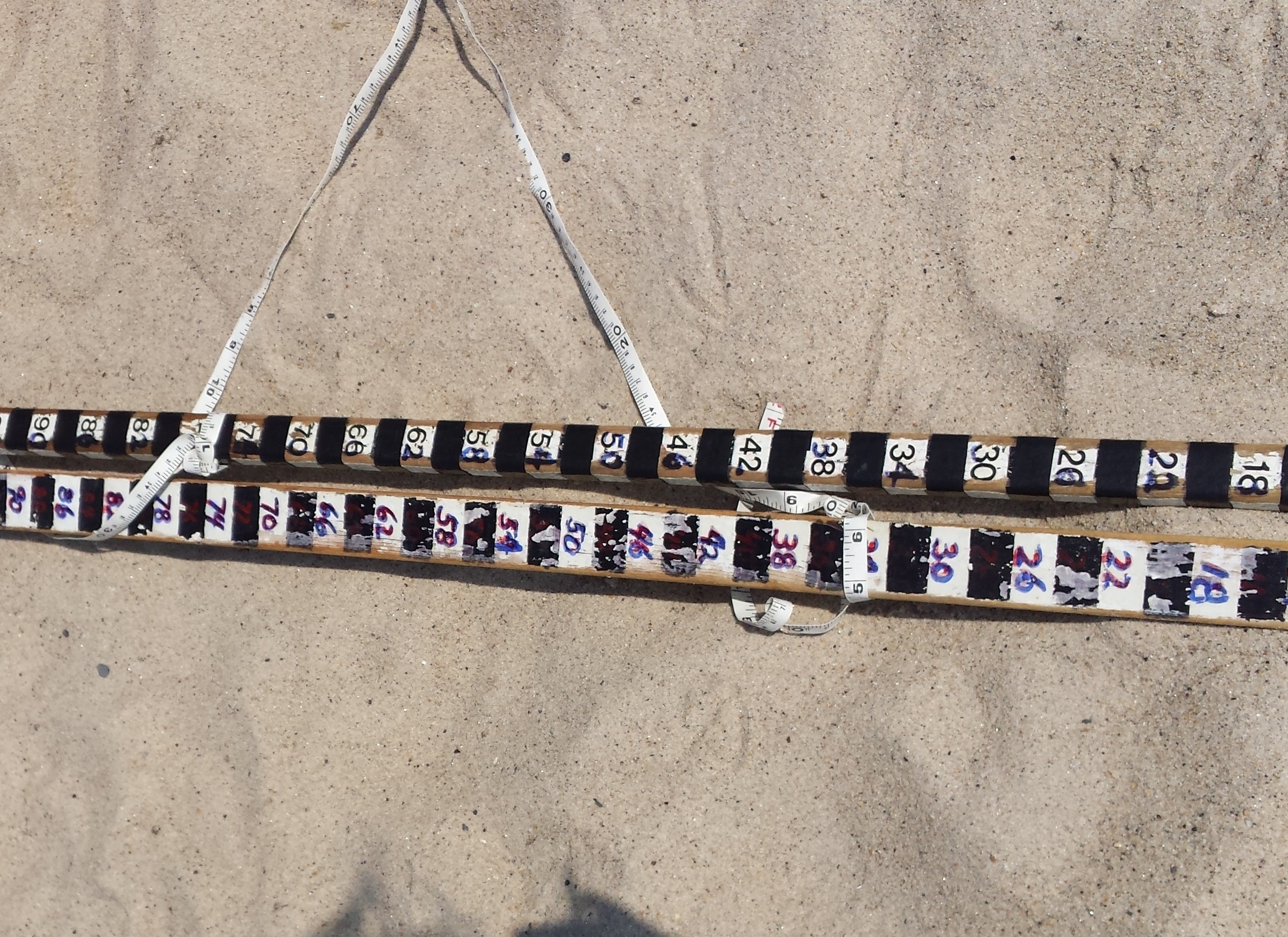
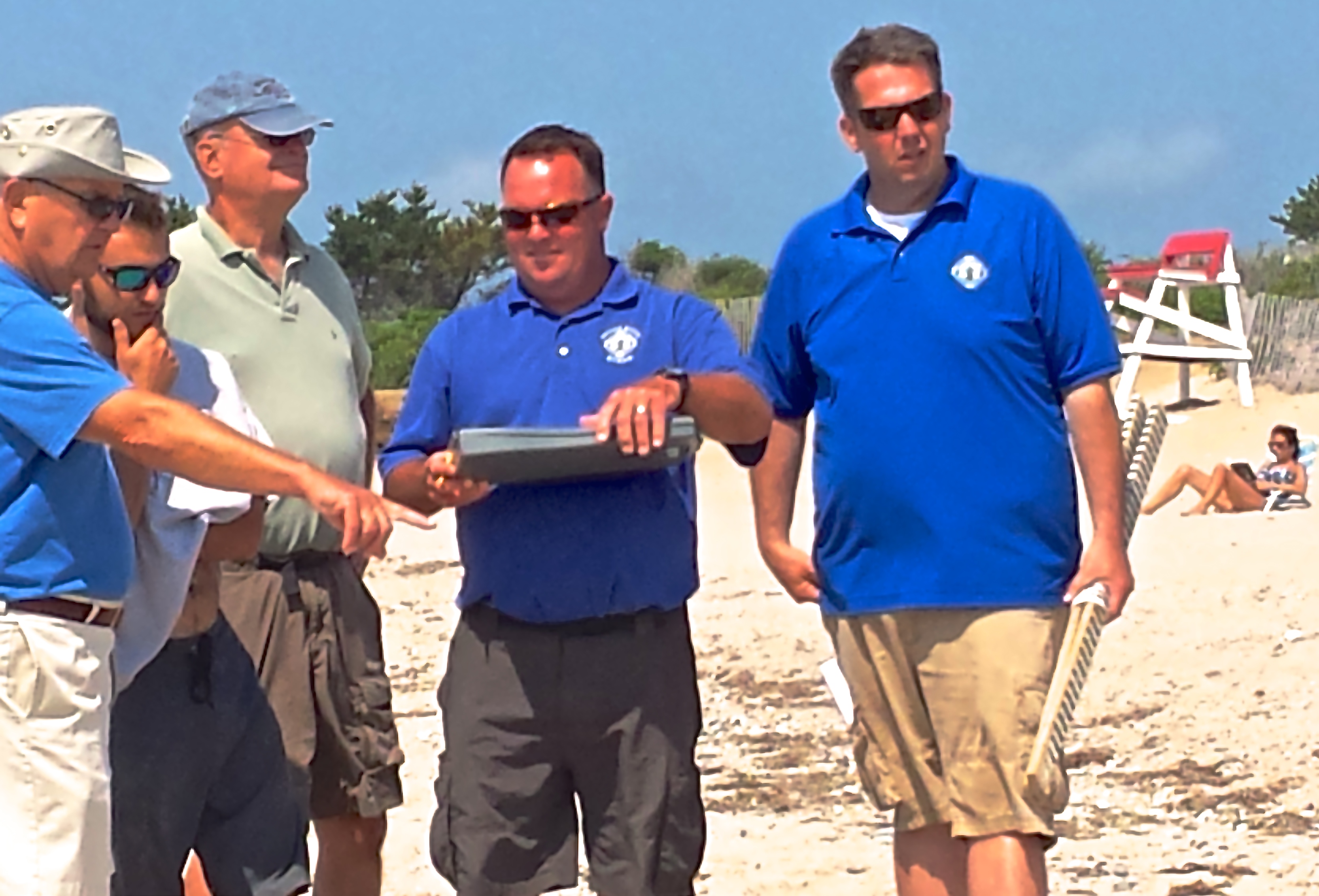
Matunuck –  Armed with just two sticks and a string,  a group of 15 environmentalists took to South Kingstown Town Beach to tackle one of the biggest issues facing Rhode Island: eroding barrier beaches.

“The reason we can hold this kind of workshop is that the technique we use to actually monitor, to create these (profiles) is with a very simple technique,” said Bryan Oakley, University of Rhode Island graduate and Asst. Professor of Environmental Earth Sciences at Eastern Connecticut State University. “We don’t have anything that costs more than $30 to build these sticks. It literally is as we call it two sticks and a string.’ ”

The training is sponsored by the Coastal Resources Management Council in collaboration with the Rhode Island Geological Survey at URI, the beach gathering was intended to encourage volunteers to actively participate in monitoring changes and collecting data on the state’s barrier beaches.

The Emory Board Method

“We like it because it doesn’t require a lot of fancy equipment, “ said Oakley. “So in this day and age of funding, we can go out and set up a new profile for very little money. It’s just time to go run the data.”

20140723_095925
Bryan Oakley (l) and Rob Hollis (c) instruct a group on the science of beach profiling. (Photo Tracey C. O’Neill)

Dubbed the Emery Board method, the profile technique was formulated by the late Kenneth O. Emery, (K.O.), Scientist Emeritus at the Woods Hole Oceanographic Institute.

“Anybody can learn how to do it. It’s just a matter of consistency and really practice,” said Oakley. “You get better, you get faster, you get more efficient the more you do it.”

“It’s a field driven technique, we like that because its easy to sit and look at GIS and look at long-term changes, to the shoreline, but a lot of the detail is, you’re out here the day after a storm, you collect the data and you can say something about how much the shoreline went away,” he said.

Janet Freedman, CRMC Coastal Geologist helps Dori Boardman with her beach sketch. (Photo Tracey C. O'Neill)
Janet Freedman, CRMC Coastal Geologist helps Dori Boardman with her beach sketch. (Photo Tracey C. O’Neill)

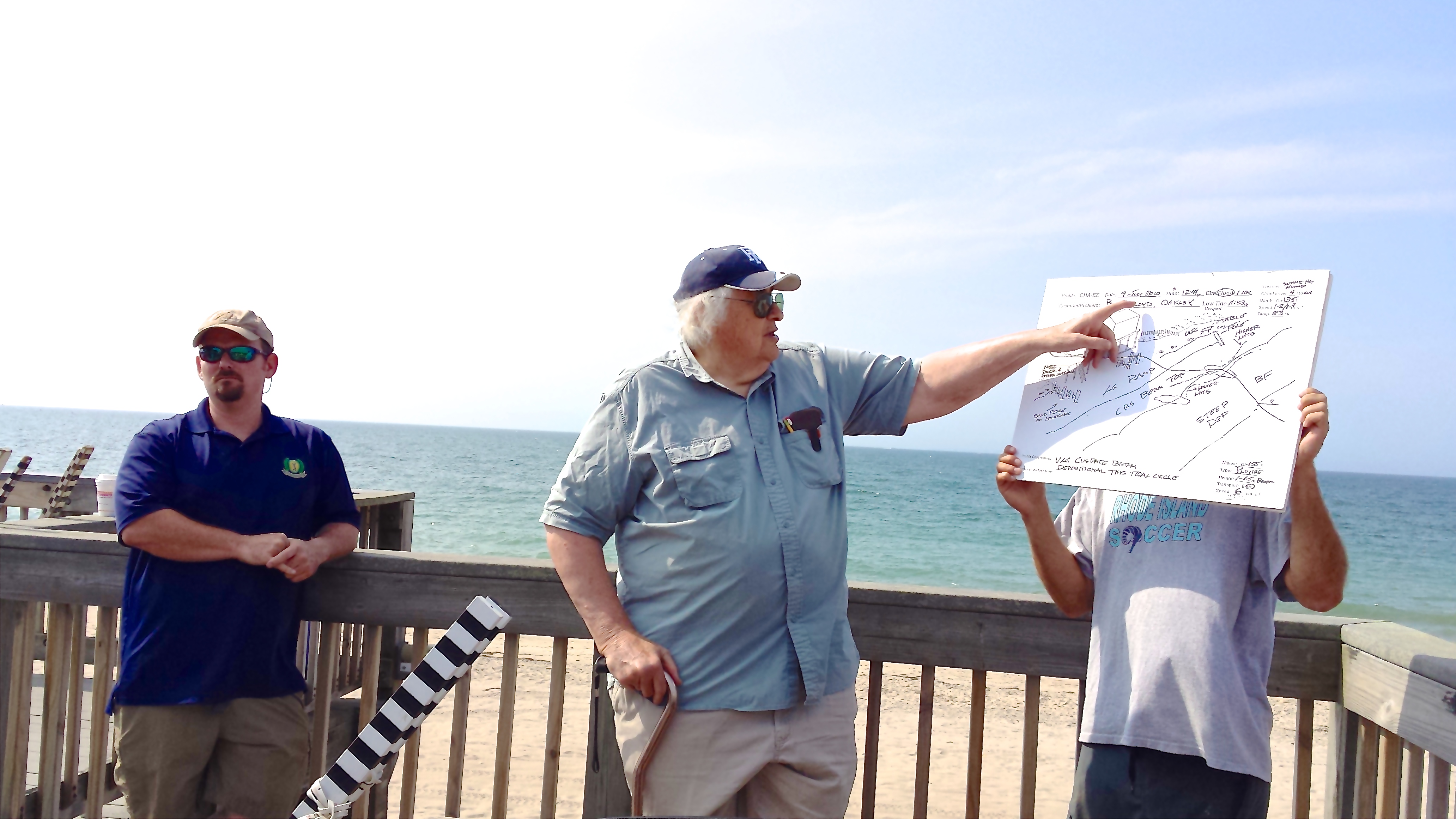
Assisting the two professors in instruction were Janet Freedman, CRMC Coastal Geologist and Rob Hollis, URI Graduate Student.

The two sticks method was also the more practical choice for volunteer profiling as the more technical, kinematic GPS systems cost anywhere from $30,000 to $60,000.

Volunteers were also given tracking, plotting and sketching instruction for future use on their chosen beaches across the state.

Spearheading the training was Dr. Jon Boothroyd, State Geologist and Research Professor Emeritus at URI’s Rhode Island Geological Survey.

“Things are about to happen here,” said Boothroyd. “They are already happening.”

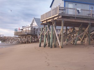
Pointing to South Kingstown Town Beach, where Boothroyd established a profile in 1996, he said, “This is a highly erodible place. It’s eroding at the same rate that some of the beaches are eroding and even more. And we think, we don’t know yet, and we hope the SAMP will shed some light on it, that there’s wave refraction around the shallower water out here. That’s a focus here.”

“The CRMC asked us to start a profile here in 1996,” Boothroyd said.

“They built this part in 1992,” he said of the town beach’s pavilion. “And they built the shore-parallel boardwalk in 1994. Almost as soon as it was built, people started noticing that the scarp and the bluff were approaching the boardwalk pilings.”

Taking care to school participants on the need for beach profiling, Boothroyd and Oakley walked the group through the history and science of the eroding shoreline. Before heading out onto the beach for hands-on training, the educators presented a basic foundation of changes and profiles generally seen on Rhode Island beaches.

Recovery takes time

Residents from multiple coastal communities took part in the training. (Photo Tracey C. O'Neill)
Residents from multiple coastal communities took part in the training. (Photo Tracey C. O’Neill)

The South Kingstown Town Beach is serving as the subject because it provides both historical and current change lessons in geology and meteorology.

“You know that the storms pass off to the east – that the wind comes in from the northeast – and we have what is known as Nor’easters,” said Boothroyd. “Everybody calls an extra- tropical cyclone a Nor’easter, but here if the storm track passes to the west, we have winds coming in from the southeast, so we really have So’easters on this coast. “[It] depends on which way your coast faces.”

Using Superstorm Sandy as a severe weather gauge, Boothroyd explained Sandy’s path and turn away from the RI coast.

“If Sandy hadn’t turned, we’d look like New Jersey. Not everyone believes it, but we dodged a bullet.”

The historical data for the beach, chronicled the changes since Sandy brought the sea ashore in Matunuck.

“Without this data, we wouldn’t know that the bluff here went back 7 meters during Sandy – the crest of the bluff,” said Oakley.

Engaging the participants, Oakley pointed to the scarp (slope formed by wave action) west of the pavilion. “So that scarp you see down there went back, 23 feet give or take during one storm.”

Natural replenishment and erosion is a long process, with intermittent storms and activity forestalling and contributing, in either positive or negative processes, the construct of the barrier beach.

“We’ve found over the years that there’s a cycle, although I’d hate to call it a cycle, but there’s a pattern,” said Boothroyd. “If you start with a very large beach with a big berm, then you have a moderate storm, severe storm, and post-storm recovery, over time it comes back. But it takes actually years to come back, so we’re still recovering here after Sandy.”

Joining the training were volunteers from Middletown, Little Compton, South Kingstown, Charlestown and Narragansett.The Narrow River Preservation Society in Narragansett, Salt Ponds Coalition,  2nd Beach, Middletown and the South Kingstown Conservation Commission were represented.

CRMC may offer additional beach profiling training sessions in the future, according to Laura Dwyer, spokesperson for CRMC.

Broken Promises in NK

NKFFA Firefighters, family & friends Tunnel to Towers 2012

Negotiations between the Town of North Kingstown and its firefighters union, IAFF Local 1651 on Wednesday ended in a mutually agreed tentative agreement. Right?

After all, Wednesday’s ten hour session at the bargaining table resulted in a Tentative Agreement, dated and signed by Town Manager, Michael Embury and the union’s representative, President Raymond Furtado. Handshakes were made and the parties left negotiations with the agreement that both parties would take the agreement back to their organizations for ratification. Right?

On Friday evening, that’s just what the North Kingstown Firefighters Association (NKFFA) did. Firefighters, union leaders and members met to ratify the agreement, returning the town’s fire personnel to their previous shift structure as ordered by Superior Court Judge Brian J. Stern on December 14, 2012. After deliberating and consideration, the membership ratified a temporary agreement saving the town damages in excess of $1 million. The good faith effort by union personnel in ending the standoff was thwarted just a few hours later.

The town council, meeting on Saturday morning in executive session, flip flopped on that agreement, voting 5-0 not to ratify. Tentative agreements are clearly tentative in North Kingstown.

Town Manager, Michael Embury in press release noted that after calling for a motion to approve, council president Liz Dolan received no response. Motion was then made by Dolan’s fellow Republican Kerri McKay to “not approve” the tentative agreement and seconded by Democrat, Richard Welch. All members, including Carol Hueston, who sat in on negotiations, voted to not approve the contract.

The firefighters plan to return to court to seek entry of order under Judge Stern’s December decision.

CRMC To Consider 2nd SK Plan for Matunuck Erosion


Deprecated: Function get_magic_quotes_gpc() is deprecated in /hermes/bosnacweb08/bosnacweb08bf/b1577/ipg.rifuturecom/RIFutureNew/wp-includes/formatting.php on line 4387

Deprecated: Function get_magic_quotes_gpc() is deprecated in /hermes/bosnacweb08/bosnacweb08bf/b1577/ipg.rifuturecom/RIFutureNew/wp-includes/formatting.php on line 4387

After its first application was struck down earlier this week, South Kingstown will present a second one to the Coastal Resources Management Council on April 24 to request shoreline reclassification of  a section of Matunuck headlands. This one has broad-reaching implications, with the reclassification of benefit to private property owners.

It requests a change in shoreline classification for eleven properties along the Matunuck shoreline east and west of the Ocean Mist.

The application, if approved would change the present coastal designation of “Coastal Headlands, Bluffs and Cliffs” to “Manmade Shoreline” for the portion of shoreline in question. The change in designation would allow business and residential property owners more flexibility in choice of protective vehicles.

The public hearing will be held on April 24, 2012 at 6pm in the South Kingstown High School auditorium.

Amid a standing room-only auditorium earlier this week, CRMC members, town officials, residents and an army of attorneys came out to voice concerns over the continued erosion of a 202 ft. expanse of beach. Cradled between man made structures and at the heart of a decades’ long battle of surf and citizenry, the short stint of shoreline is the hub of much community activity.

After hours of testimony, CRMC ended the meeting denying a special exception needed for the project and subsequently voting the application down.

The project presented by Steve Alfred, Town Manager and Public Safety Director, was submitted through application to CRMC in September 2011. Calling for construction of a sheet pile wall with riprap stone armaments, the steel and concrete construction was limited to a critical 202 ft. span of road threatened by the ocean to the south.

Matunuck Beach Road houses the community water line and provides the only road access in and out of the area.

“Failure of the road is a critical public health and safety concern,” said Alfred. People east of the section in question would be without water, fire and emergency services access should the road and underlying line fail.

The rip-rap structure is generally frowned upon by coastal environmentalists as a beach erosion solution and an invasive means of providing for the needs of property owners.

Representatives of several environmental and coastal agencies came forward to voice opposition to the project. Jane Austin, Special Coalitions Liaison for Save the Bay urged CRMC to deny the application as posed. Speaking to CRMC’s Red Book and shoreline protection laws, Austin called upon the Council to advocate for the coastline.

“CRMC should exercise leadership through its handling of the Matunuck issue. Hardening shorelines results in loss of the natural and dynamic boundary between the land and sea, a boundary important for habitat and marine productivity.” While all parties were in agreement that the need for action had passed, each stood its ground in the ever-present tug of war of personal priorities.

Paul Lemont, CRMC member commending the work of the organization, asked Austin to provide a possible remedy. “Every time we get together, all we hear are the negatives,” said Lemont. “Something needs to be done.”

A measured assault on the Town’s plans came from all sides. At every turn came the phrase “the wall will exacerbate the problem.” The wall as proposed would not provide protection from storm surge and flooding. Floodwaters caught roadside, behind the wall would have to dissipate naturally with no vehicle of return built into the project.

“The waters would exit to the east and west and flow under the Ocean Mist property,” explained Robert Fairbanks, an engineer who designed the bulkhead for the Town. “The return is the Ocean Mist. That is how it is happening today.”

Stephen Reid, Jr., representing the owners of the Ocean Mist and Tara’s Pub, both properties sitting on 675 feet of unprotected shoreline extending east to a man-made abutment, questioned the viability of the Town’s plan and apparent lack of interest in finding suitable alternatives. “They have blinders on – sheet pile blinders. They are going to drive the pile along that 202 feet of Matunuck Beach Road.”

Reid hammered home the absence of plan protection for the private property owners, firing questions at Fairbanks. Affirming the project’s primary purpose in protecting the road, Fairbanks shored up Reid’s arguments. The 200 feet of sheet pile wall would not prevent further beach erosion, provide protection for the adjacent property or prevent flooding of the road. In fact, the wall construction would exacerbate the existing beach erosion problem seaward.

“If there is further erosion, the Ocean Mist and all of those properties are going to have a huge problem,” cautioned Fairbanks.

Reid reminded Council members that any riprap structure in support of the sheet pile wall would have to be placed on property not currently owned by the town. “The property owner where the riprap would have to go is Mary Carpenter. My client is in negotiations to purchase that property from Mary Carpenter. The Town has no place to put the riprap,” said Reid.

A right of first refusal to the parcel where the riprap would be extended is currently held by Kevin Finnegan, owner of the Ocean Mist property. The Town also considered purchasing the two parcels directly west of the Ocean Mist as a means of furthering the project. The question of the Town’s ability to provide for the riprap support brought rebuttal from the Town Manager.

“If the right of first refusal is exercised, [we] are prepared to take it through eminent domain. It is not accurate to say that it could not be accomplished,” noted Alfred.

Anthony Affigne, appointed to CRMC last fall, questioned the project’s merits. “I’ve been down there a lot. It’s clear that something needs to be done. I just don’t think this is the answer. I plan to vote no on the request for special exception.”

The Council in roll call agreed, bringing only two votes in favor of the special exception and application.

More than six months have passed since the Town’s application was filed. During that time, Rhode Island coasted through a mild winter with Matunuck property owners being spared the wrath of significant winter storms. The sheet pile wall project set aside lends no answers for the beach community of Matunuck.