And apparently nobody did. I’ve seen articles in the paper. I’ve even tweeted reporters. Nobody’s asking the question, “Is this stadium going to be built on stilts?”
Here’s my mock-up of the location of the stadium cobbled together from the rough info we’ve received, plus an overlay of the flood zone maps.
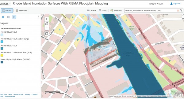
This map assumes sea level rises and storm surges. It doesn’t have potential hurricane or the 100 year flood levels.
So, here’s the pitch question…
“What are the new Sox owner’s plans to deal with or mitigate flooding during and after construction of a proposed stadium?”
Disclosures: I love baseball. I love Providence. I like the Pawsox. I don’t like public subsidies of businesses that will make millions and return little in the way of revenue and long-term growth/momentum to a city. Oh, and I’m not a GIS mapper…
]]>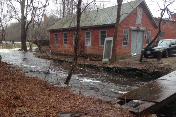
In case you don’t know, the RI Future newsroom (aka the Hideaway) is located behind the Shady Lea Mill in North Kingstown just below a waterfall on the Mattatuxet River. I pretty much think I have the most beautiful non-coastal office in the Ocean State.
But it isn’t at all without its downsides. One of which is that a 100 year flood will destroy this place. Yesterday was not the flood, but it’s probably coming and it’s probably coming sooner rather than later. When it does, I just hope I’m here to document it….
Check out my pictures from yesterday’s near-flood (and more pictures and whatnot of the area on my Shady Lea blog).
]]>