Beluga whales spotted in Narragansett Bay


Deprecated: Function get_magic_quotes_gpc() is deprecated in /hermes/bosnacweb08/bosnacweb08bf/b1577/ipg.rifuturecom/RIFutureNew/wp-includes/formatting.php on line 4387

Deprecated: Function get_magic_quotes_gpc() is deprecated in /hermes/bosnacweb08/bosnacweb08bf/b1577/ipg.rifuturecom/RIFutureNew/wp-includes/formatting.php on line 4387
beluga
Click on the image for more of David DeSalvo’s pictures of the beluga whales.

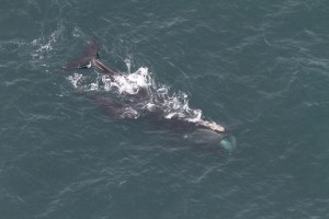
How rare of a marine mammal sighting are the beluga whales that have been spotted at various locations in Narragansett Bay on Sunday and Monday?

“It’s the second one ever in Rhode Island,” said Bob Kenney, an oceanography professor at the URI Bay Campus who studies whales and wrote this about belugas.

“The first one was last year,” he added.

In July, 2014, a fisherman spotted and videoed a lone beluga whale in the West Passage between Jamestown and Saunderstown. At roughly the same time, a second beluga whale was seen in the Taunton River near Fall River last year.

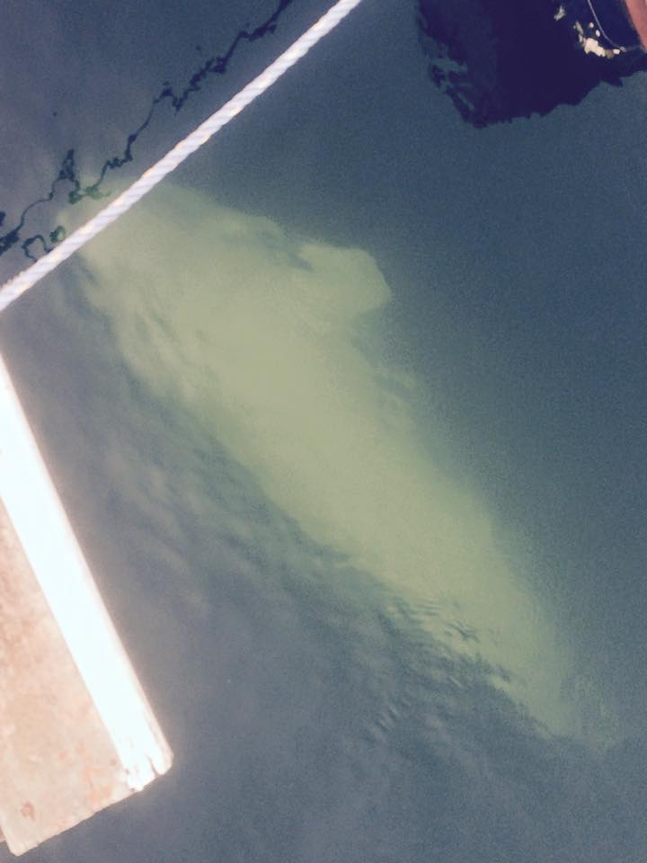
Then on Sunday, David DeSalvo and Matt King videoed three beluga whales north of the Newport Bridge and just off the eastern shore of Jamestown. DeSalvo estimated they were about 12 to 15 feet long.

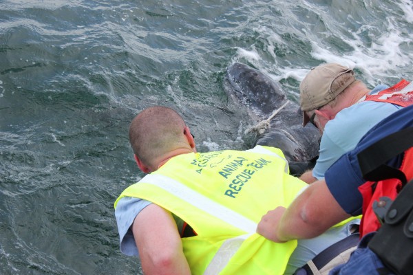
On Monday morning, the RI Department of Environmental Management fielded reports that the three beluga whales were seen further north up Narragansett Bay off Rocky Point in Warwick. A team from DEM and Mystic Aquarium dispatched a 22-ft research boat, crewed by two biologists and a veterinarian, to ensure the mammals are healthy on Monday. They appeared healthy in the video, said April Valliere, a supervising biologist who studies marine mammals with DEM.

She said increasingly colder waters in southern New England may be enticing beluga whales from their native habitat of the St. Lawrence Seaway in northeastern North America.

“I suspect cooler water temperatures have something to do with it,” she told me. “It’s off several degrees. It’s still in the 40’s outside the Bay.”

But she said scientists really don’t know yet. “We’re not really sure. Obviously there is food for them,” she said, noting that squid and menhaden are now running in Narragansett Bay.

There’s a theory that the heavily-polluted St. Lawrence may be causing cancer in beluga whales. Perhaps the pearl white whales are relocating to a cleaner habitat? In a Providence Journal op/ed last year, Mystic Aquarium President Steven Coan said a changing climate is opening up new southern habitat to beluga whales. “The sight of a Beluga in southern New England is rare and unusual today but could quickly become a more frequent occurrence. Climate change is affecting our seas and the creatures that live in them. In some cases the natural food supply for a certain species may shift location, moving to a warmer or cooler spot in the ocean.

Beluga whales aren’t the only whales that visit Narragansett Bay. Minkie whales frequent the lower Bay as does the occasional fin whale in the winter. Several species of whales live in or pass through the Rhode Island and Block Island sounds, the parts of the Atlantic off the coast of Rhode Island.

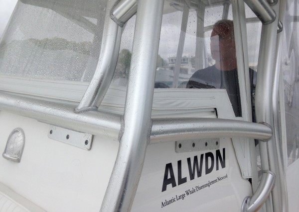
Whales are protected by the Marine Mammal Protection Act, and as such it’s a felony to disturb them. Boaters, Kenney and Valliere both stressed, should take extreme caution.

“Anything a boater does that disturbs teir natural behaviors is a violation of federal law, you could go to jail for up to two years” Kenney said. “The best thing to do is shut the engine down and watch them. They may just come close. But don’t chase them.”

Volvo fleet flies into Newport, RI


Deprecated: Function get_magic_quotes_gpc() is deprecated in /hermes/bosnacweb08/bosnacweb08bf/b1577/ipg.rifuturecom/RIFutureNew/wp-includes/formatting.php on line 4387

Deprecated: Function get_magic_quotes_gpc() is deprecated in /hermes/bosnacweb08/bosnacweb08bf/b1577/ipg.rifuturecom/RIFutureNew/wp-includes/formatting.php on line 4387

RI Future Sailing Correspondent Roberto Bessin was at Ft. Weatherill State Park in Jamestown to see Team SCA enter Narragansett Bay after a 5,000 mile sail from Brazil – the sixth leg in this year’s Volvo Ocean Race, which made port in Newport last night and this morning.

SCA, the only all-women boat competing in bi-annual race, brought up the rear, finishing at about 10am. Dongfeng, a team made up of Chinese and French sailors, finished almost exactly 12 hours earlier. They beat Team Abu Dabi by only 3 minutes, in an exciting night of sailing that saw hundreds of boaters welcome them to Rhode Island. Team Almevidica, captained and partially crewed by Rhode Islanders, finished 5th of 6 at 3am.

volvo_sca_castle hill
Team SCA passes Castle Hill Lighthouse in Newport, as it enters the West Passage of Narragansett Bay. (Roberto Bessin)
You can see the coast of Block Island behind Team SCA in this one. (Photo by Roberto Bessin.
You can see the coast of Block Island behind SCA’s 65-foot sailboat in this picture. (Roberto Bessin)
Team SCA passes Hammersmith Farm, the former Kennedy estate in Newport, as a helicopter flies overhead. (Photo by Roberto Bessin)
SCA passes Hammersmith Farm, the former Kennedy estate in Newport, as a helicopter flies overhead. (Roberto Bessin)
The six remaining boats - one crashed into a reef in the middle of the ocean - docked at Ft. Adams in Newport, where an entire temporary "village" has been created for the 12 day event. (Photo by Roberto Bessin)
The six remaining boats – one crashed into a reef in the middle of the ocean – are docked at Ft. Adams in Newport, where an entire temporary “village” has been created for the 12 day event. (Roberto Bessin)
(Roberto Bessin)
Team Abu Dabi’s boat, with the state-owned tall ship Oliver Hazard Perry to her stern (Roberto Bessin)
Team Alvimedica's boat in gorgeous Newport Harbor. (Roberto Bessin)
Team Alvimedica’s boat in gorgeous Newport Harbor. (Roberto Bessin)
The six competing Volvo boats and the Oliver Hazard Perry at Ft. Adams in Newport, RI. (Roberto Bessin)

Volvo Ocean Race sails toward Newport, RI


Deprecated: Function get_magic_quotes_gpc() is deprecated in /hermes/bosnacweb08/bosnacweb08bf/b1577/ipg.rifuturecom/RIFutureNew/wp-includes/formatting.php on line 4387

Deprecated: Function get_magic_quotes_gpc() is deprecated in /hermes/bosnacweb08/bosnacweb08bf/b1577/ipg.rifuturecom/RIFutureNew/wp-includes/formatting.php on line 4387
Volvo Ocean Race, Itajai, Brazil in April. Nest stop Newport.
Volvo Ocean Race, Itajai, Brazil in April. Next stop Newport, RI.

The first solo sailor to circumnavigate the earth in 1898 had to hug the Castle Hill coastline as he finished his 47,000 mile voyage in Newport, Rhode Island. Joshua Slocum was dodging the lethal shipping mines planted at the entrance of Narragansett Bay during the Spanish American War. After surviving two years and 47,000 miles at sea, he was at risk of being blown up just miles from the finish line.

The six teams racing in the Volvo Ocean Race face no such perils. Only the Atlantic Ocean stands between them and Newport Harbor, where they will complete the sixth leg of the around-the-globe race on approximately May 5. With some 4,000 nautical miles between them and Newport, their arrival time is still a guess. This Volvo Race, sailing’s biggest biannual event, has previously stopped at Alicante, Spain, Capetown, South Africa, Abu Dhabi, Sanya, China, Auckland, New Zealand, and Itajai, Brazil . They’ll be in Newport from May 5 through the 17th, when they set sail for Lisbon, Portugal, the next leg of the what used to be known as the Whitbread Round the World Race.

When Slocum sailed around the world, he sailed a wooden 37-ft. oyster boat. The Volvo Ocean Race chose the Farr Ocean 65 for 2014-15, and basically established a new one-design fleet of carbon fiber rocket ships. Instead of the weird and disparate multi-hull competitors in what the America’s Cup race has evolved into, the Volvo boats are very similar. Because of that, right now, the boats have been sailing at close quarters for the first three days of the current leg. Often the difference in speed is a mere 0.2 knots.

Team Alvimedica has three Rhode Islanders aboard: Charlie Enright, the skipper, Mark Towhill, the general manager and Amory Ross, the reporter. Charlie and Mark, both with formidable offshore sailing experience around the world, know each other from the Brown Sailing team years ago. With advice from PUMA Ocean racing veterans, they put a world class team together. They are highly motivated to win this leg, and have a great number of fans here in Rhode island.

Team SCA, one of six current competitors, is writing history with an all women’s crew. Corinna Halloran, from Newport, is aboard SCA as a reporter. The 15 women comprising Team SCA come from six countries including Switzerland, Sweden, Great Britain, Australia, US, and the Netherlands. SCA is the largest private forester in Europe and manufacturers paper products marketed internationally. The 15 women were chosen from 250 applicants. Skipper, Sam Davies, took fourth in the recent Vende Solo Race, and she leads a talented crew. What has been mainly a playing field for men over the years has opened up, with due respect to Isabelle Autissier, and Ellen MacArthur.

A seventh competitor, Team Vestas Wind from New Zealand sailed up onto a reef in the Indian Ocean on an earlier leg of this year’s Volvo Ocean Race. The last harrowing moments were caught on video:

It is exciting to see Newport once again hosting a world class sailing event, and how great it is with such equal boats pitting sailor versus sailor, for unpredictable, close competition. The inshore race May 15th and 16th will be in the West Passage outside of Newport Harbor, visible from many vantage points in Newport and Jamestown. It should be thrilling to watch the Volvo boats sail under the Newport Bridge. And then the VOR departs for Portugal, France, and Sweden, to finish off 38,739 nautical miles of blue water sailing. For the sailors it means more freeze dried food and only one change of clothes at sea.

I’ve been a sailor for 45 years. I grew up sailing on San Francisco Bay, I’ve sailed across the Atlantic twice and I’ve sailed the Mediterranean and the Caribbean seas. This Volvo race reminds me why I moved to Newport more than 20 years ago.

Tackling beach erosion with two sticks and a string


Deprecated: Function get_magic_quotes_gpc() is deprecated in /hermes/bosnacweb08/bosnacweb08bf/b1577/ipg.rifuturecom/RIFutureNew/wp-includes/formatting.php on line 4387

Deprecated: Function get_magic_quotes_gpc() is deprecated in /hermes/bosnacweb08/bosnacweb08bf/b1577/ipg.rifuturecom/RIFutureNew/wp-includes/formatting.php on line 4387
Jon Boothroyd and Bryan Oakley, Geologists with the Rhode Island Geological Survey provide a historical account of coastal erosion in South Kingstown. (Photo Tracey C. O'Neill)
Jon Boothroyd and Bryan Oakley, Geologists with the Rhode Island Geological Survey provide a historical account of coastal erosion in South Kingstown. (Photo Tracey C. O’Neill)

Matunuck –  Armed with just two sticks and a string,  a group of 15 environmentalists took to South Kingstown Town Beach to tackle one of the biggest issues facing Rhode Island: eroding barrier beaches.

“The reason we can hold this kind of workshop is that the technique we use to actually monitor, to create these (profiles) is with a very simple technique,” said Bryan Oakley, University of Rhode Island graduate and Asst. Professor of Environmental Earth Sciences at Eastern Connecticut State University. “We don’t have anything that costs more than $30 to build these sticks. It literally is as we call it two sticks and a string.’ ”

The training is sponsored by the Coastal Resources Management Council in collaboration with the Rhode Island Geological Survey at URI, the beach gathering was intended to encourage volunteers to actively participate in monitoring changes and collecting data on the state’s barrier beaches.

The Emory Board Method

“We like it because it doesn’t require a lot of fancy equipment, “ said Oakley. “So in this day and age of funding, we can go out and set up a new profile for very little money. It’s just time to go run the data.”

20140723_095925
Bryan Oakley (l) and Rob Hollis (c) instruct a group on the science of beach profiling. (Photo Tracey C. O’Neill)

Dubbed the Emery Board method, the profile technique was formulated by the late Kenneth O. Emery, (K.O.), Scientist Emeritus at the Woods Hole Oceanographic Institute.

“Anybody can learn how to do it. It’s just a matter of consistency and really practice,” said Oakley. “You get better, you get faster, you get more efficient the more you do it.”

“It’s a field driven technique, we like that because its easy to sit and look at GIS and look at long-term changes, to the shoreline, but a lot of the detail is, you’re out here the day after a storm, you collect the data and you can say something about how much the shoreline went away,” he said.

Janet Freedman, CRMC Coastal Geologist helps Dori Boardman with her beach sketch. (Photo Tracey C. O'Neill)
Janet Freedman, CRMC Coastal Geologist helps Dori Boardman with her beach sketch. (Photo Tracey C. O’Neill)

Assisting the two professors in instruction were Janet Freedman, CRMC Coastal Geologist and Rob Hollis, URI Graduate Student.

The two sticks method was also the more practical choice for volunteer profiling as the more technical, kinematic GPS systems cost anywhere from $30,000 to $60,000.

Volunteers were also given tracking, plotting and sketching instruction for future use on their chosen beaches across the state.

Spearheading the training was Dr. Jon Boothroyd, State Geologist and Research Professor Emeritus at URI’s Rhode Island Geological Survey.

“Things are about to happen here,” said Boothroyd. “They are already happening.”

Pointing to South Kingstown Town Beach, where Boothroyd established a profile in 1996, he said, “This is a highly erodible place. It’s eroding at the same rate that some of the beaches are eroding and even more. And we think, we don’t know yet, and we hope the SAMP will shed some light on it, that there’s wave refraction around the shallower water out here. That’s a focus here.”

“The CRMC asked us to start a profile here in 1996,” Boothroyd said.

“They built this part in 1992,” he said of the town beach’s pavilion. “And they built the shore-parallel boardwalk in 1994. Almost as soon as it was built, people started noticing that the scarp and the bluff were approaching the boardwalk pilings.”

Taking care to school participants on the need for beach profiling, Boothroyd and Oakley walked the group through the history and science of the eroding shoreline. Before heading out onto the beach for hands-on training, the educators presented a basic foundation of changes and profiles generally seen on Rhode Island beaches.

Recovery takes time

Residents from multiple coastal communities took part in the training. (Photo Tracey C. O'Neill)
Residents from multiple coastal communities took part in the training. (Photo Tracey C. O’Neill)

The South Kingstown Town Beach is serving as the subject because it provides both historical and current change lessons in geology and meteorology.

“You know that the storms pass off to the east – that the wind comes in from the northeast – and we have what is known as Nor’easters,” said Boothroyd. “Everybody calls an extra- tropical cyclone a Nor’easter, but here if the storm track passes to the west, we have winds coming in from the southeast, so we really have So’easters on this coast. “[It] depends on which way your coast faces.”

Using Superstorm Sandy as a severe weather gauge, Boothroyd explained Sandy’s path and turn away from the RI coast.

“If Sandy hadn’t turned, we’d look like New Jersey. Not everyone believes it, but we dodged a bullet.”

The historical data for the beach, chronicled the changes since Sandy brought the sea ashore in Matunuck.

“Without this data, we wouldn’t know that the bluff here went back 7 meters during Sandy – the crest of the bluff,” said Oakley.

Engaging the participants, Oakley pointed to the scarp (slope formed by wave action) west of the pavilion. “So that scarp you see down there went back, 23 feet give or take during one storm.”

Natural replenishment and erosion is a long process, with intermittent storms and activity forestalling and contributing, in either positive or negative processes, the construct of the barrier beach.

“We’ve found over the years that there’s a cycle, although I’d hate to call it a cycle, but there’s a pattern,” said Boothroyd. “If you start with a very large beach with a big berm, then you have a moderate storm, severe storm, and post-storm recovery, over time it comes back. But it takes actually years to come back, so we’re still recovering here after Sandy.”

Joining the training were volunteers from Middletown, Little Compton, South Kingstown, Charlestown and Narragansett.The Narrow River Preservation Society in Narragansett, Salt Ponds Coalition,  2nd Beach, Middletown and the South Kingstown Conservation Commission were represented.

CRMC may offer additional beach profiling training sessions in the future, according to Laura Dwyer, spokesperson for CRMC.

We need to celebrate Bay Day every day


Deprecated: Function get_magic_quotes_gpc() is deprecated in /hermes/bosnacweb08/bosnacweb08bf/b1577/ipg.rifuturecom/RIFutureNew/wp-includes/formatting.php on line 4387

Deprecated: Function get_magic_quotes_gpc() is deprecated in /hermes/bosnacweb08/bosnacweb08bf/b1577/ipg.rifuturecom/RIFutureNew/wp-includes/formatting.php on line 4387
at beach
Click on the image to read the 2014 Watershed Counts report.

It was Governor’s Bay Day this past weekend, where the bonus was free parking and free transportation to the state beaches in Narragansett Bay and along the Atlantic coast, widely acclaimed as some of the most beautiful shoreline in the world. Beaches are not normally free as user fees help maintain and protect these valuable natural assets.

Over the last several years, many towns like Bristol and Newport have invested millions in infrastructure to protect Bristol Town Beach, Easton’s (First) Beach in Newport, and other local beaches. These improvements come at a cost, but they are critical long-term investments to help keep beaches open and avoid costly beach closures. When beaches are open, local economies that rely upon beachgoers and tourists reap measurable returns. Visitors that enjoy these clean beaches also return to enjoy future beach seasons. A new report by Watershed Counts was issued this week that celebrates these investments to protect water quality at our beaches, and gives the public a full assessment of their current health.

The 2014 Watershed Counts Report [RI Future story here] details how the summer of 2013 saw impressive rain totals. Normally, a pattern of excessive rain translates into a large number of beaches closures. This is because rain washes pollution and bacteria into our coastal waters and beaches must be closed by the health departments to protect people from disease. But 2013 was different for those towns that had the foresight and financial backbone to tackle these issues. Newport invested over $6 million to build an ultraviolet plant to disinfect water before it affects beachgoers; and the Town of Bristol transformed Bristol Town Beach by installing numerous green infrastructure safeguards to protect beach water quality. Neither of these beaches was closed last year.

In fact, the report shows that there were fewer beach closures in 2013 compared to past rainy years, which means that investments are paying off through reduced water pollution. All along the shores of Narragansett Bay and the coast, similar plans are emerging. Many local leaders understand that clean and open beaches are important to residents and are a catalyst to a healthy economy. Clean and healthy waters create jobs in the marine trades, fishing, shellfishing, and the tourism and hospitality industries. Property values also benefit from clean waterways.

However, the 2014 Watershed Counts Report also provides a note of caution that the increased challenges of climate change may bring additional threats to our beaches, such as sea level rise, rising temperatures, and more intense and frequent storms. All of these impacts have the potential to close beaches more often due to water quality concerns caused by stormwater and wastewater pollution. Increased temperatures enhance the breeding ground for harmful bacteria, and more frequent and intense storms mean more pollutants are deposited at local beaches. In addition, many of our beaches are bordered by buildings and other hardened surface structures, such as parking lots, that prevent beaches from naturally migrating inland in response to rising sea levels.

Yet another issue raised in the 2014 Watershed Counts Report is a lack of dedicated state funding to allow Rhode Island and Massachusetts health agencies to monitor how clean our beaches really are. We close beaches to protect public health, but we only know when to close them when we test beach water quality. Presently, the vast majority of funding for marine beach monitoring comes from federal support from the U.S. Environmental Protection Agency. While the states appreciate these federal funds to monitor water quality, this federal program has recently been at issue for possible elimination in federal budget talks. In addition, there is no state or federal funding to test water quality at our freshwater beaches, which are central to summer recreation in many Rhode Island and Massachusetts communities.

Watershed Counts, co-led by the University of Rhode Island’s Coastal Institute and the Narragansett Bay Estuary Program, is a partnership of 60 state and federal agencies, non-governmental organizations, municipalities and watershed groups that annually assesses the environmental quality of the Narragansett Bay watershed, 60% of which is in Massachusetts. Watershed Counts constantly stresses the fact that Narragansett Bay and our coastline are not only our leading environmental resource, but its most vital economic asset as well. See the 2014 Watershed Counts Report at www.watershedcounts.org.

Beaches are deeply embedded in the culture of Rhode Island and Massachusetts. Ask any resident why they live here, or ask any visitor why they return year after year, and they will likely say it’s because they enjoy the beautiful waters of the Atlantic Ocean or Narragansett Bay. It is time for other municipalities to follow the examples set by Bristol and Newport and invest in our beaches. It is also time for Rhode Island and Massachusetts to identify a funding source to monitor beach water quality as federal funding will likely wash away with the tide.

By Judith Swift, Nicole Rohr, and Tom Borden. Swift is the Director and Rohr the Assistant Director at the University of Rhode Island’s Coastal Institute. Tom Borden is the Program Director at the Narragansett Bay Estuary Program.

Watershed Counts report: Or why rain is bad for the beach


Deprecated: Function get_magic_quotes_gpc() is deprecated in /hermes/bosnacweb08/bosnacweb08bf/b1577/ipg.rifuturecom/RIFutureNew/wp-includes/formatting.php on line 4387

Deprecated: Function get_magic_quotes_gpc() is deprecated in /hermes/bosnacweb08/bosnacweb08bf/b1577/ipg.rifuturecom/RIFutureNew/wp-includes/formatting.php on line 4387
at beach
Click on the image to read the full 2014 Watershed Counts report

Governor’s Bay Day, when all Rhode Island state beaches celebrate the Ocean State by offering free admission and parking, was washed out by a driving rain yesterday. This is bad news for Rhode Island even if you didn’t miss a free beach day yesterday.

“Our beaches will be the bellwether of climate change,” said Judith Swift, executive director of URI’s Coastal Institute. “Not only will we lose beaches due to sea level rise, but increased precipitation will add additional pollutants to our beaches from stormwater runoff.”

Swift was speaking about the new 2014 Watershed Counts report, released today (you can read the full report here). But weather like yesterday’s is one of the reasons we should pay close attention to the report’s findings.

“Beach closures,” according to the press release, “are very much dependent upon rainfall, as stormwater flushes out pollutants and bacteria that close both beaches and shellfishing areas.”

The report explains: “Annual average precipitation … has been increasing over the last century and this trend is projected to continue. When you look at the pattern of rainfall, something else becomes apparent: the frequency of intense rainfall events has also increased. When we get large amounts of precipitation in a short amount of time, the stormwater runoff can overwhelm our treatment facilities and result in sewage being flushed into the Narragansett Bay.”

And shows it in a cartoon, as well:

Click on the image to read the full report.

There were 41 beach closures last summer. This summer there are currently five closures – at First Beach in Middletown, the Bristol and Warren town beaches and two beaches in Tiverton. This rain event will surely lead to even more this week. (RI Future reported on the scientific causes of beach closures, their economic effects and how RI monitors the water last summer).

But the good news is while we had heavy rains last summer, we experienced fewer beach closings than previous summers. There were 86 beach closures in 2009, 55 in 2010 and 45 in 2011. The Watershed Counts report says the counter-intuitive decrease in closures can be attributed because of public investments to control stormwater runoff, sewer overflow.

“Using green infrastructure and other best management practices to protect beach water quality is paying off,” said Department of Environmental Management Director Janet Coit. “DEM welcomes the opportunity to partner with cities and towns to enhance what is a time-honored Rhode Island tradition – enjoying a glorious day at the beach.”

A clean water/open space bond on the November ballot, if approved by voters, would invest $20 million to further clean water and segregate sewage and stormwater overflow, according to the report, but that’s only a fraction of the need. “Municipalities and the Narragansett Bay Commission have identified more than $1.8 billion dollars of needed clean water in frastructure improvements ranging from wastewater treatment upgrades and storm water quality improvements to combined sewer overflow abatement projects,” according to DEM in the report.

“The opportunity to promote and invest in a beautiful Rhode Island is significant, and the need for that investment is immediate,” according to a DEM statement in the report. “Rhode Island’s greatest natural resource and a key driver to economic growth—Narragansett Bay—is threatened by polluted run-off and the damaging effects of climate change. Conversely, local food markets are booming, horticultural, and agricultural and landscape companies are doing more local business than ever, and our $2.26 billion dollar tourism sector is growing.”

According to the press release, there has been a “surprising” lack of support from the state to monitor water quality at local beaches.

“The funding for marine beach monitoring comes mostly from federal sources. The National Beach Program provided over $200,000 to both Rhode Island and Massachusetts in 2013,” it reads. “The state budgets contained no funding, despite the fact that beaches are an economic driver, and that the federal monitoring program for saltwater beaches has recently been at issue for possible elimination in federal budget talks.”

Oysters: the Ocean State’s aquaculture cash crop


Deprecated: Function get_magic_quotes_gpc() is deprecated in /hermes/bosnacweb08/bosnacweb08bf/b1577/ipg.rifuturecom/RIFutureNew/wp-includes/formatting.php on line 4387

Deprecated: Function get_magic_quotes_gpc() is deprecated in /hermes/bosnacweb08/bosnacweb08bf/b1577/ipg.rifuturecom/RIFutureNew/wp-includes/formatting.php on line 4387

Mark Goerner was a local lobsterman for twenty years before the fishery started to dry up.
goerner

He still works the waters of the West Passage of Narragansett Bay in the Newshell, his bright red Novi (Nova Scotia-style fishing boat) often docked at Ft. Getty in Jamestown.

newshell
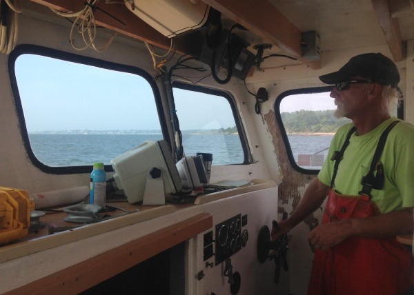
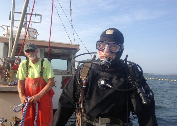
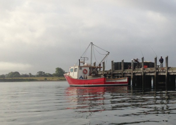
But he doesn’t look for lobster traps anymore. Now he uses the Newshell to service his oyster farm just south of the Jamestown Bridge.

oyster farm

There are 52 oyster farms in Rhode Island spread out over 176 acres – a little more than half in Narragansett Bay (one as far north as Warwick) with the remaining 82 acres in one of four South County salt ponds.

As recently as the early 1990’s, there were no oysters in Narragansett Bay. Or not nearly enough to make any money harvesting. Then Bob “Skid” Rheault applied for an aquaculture permit with CRMC. “He was the vanguard,” explained Dale Leavitt, an aquaculture expert at Roger Williams University. “It was a three or four year permitting process.”

Since then the industry has boomed, according to state Coastal Resources Management Council data. In 2013, Rhode Island aquaculturists sold more than 6 million oysters.

oyster production
CRMC

That means real money for the many restaurants, seafood stores and oyster bars that sell this delectable shellfish.”It’s providing local seafood in an era when most of our fish is imported,” said David Beutel, CRMC aquaculture coordinator. “That’s certainly valuable to us as a state.”

value aquaculture
CRMC

What’s more, Beutel and Leavitt both said oysters improve water quality. The shellfish filter fish-kill inducing nutrients out of Narragansett Bay. An oysters can filter 50 gallons of water daily, according to Leavitt. “They provide an important ecological service,” he said.

Wikipedia
Wikipedia

The average oyster take about 18 months to mature, said Beutel, and are then sold to local distributors who sell them here in Rhode Island and in 47 other states. Beutel said Alaska and Hawaii were on the list, and he wasn’t certain which two states were not.

They are grown in cages that typically float five or 10 feet below the surface.

oyster cage

“We have an industry that creates more jobs, creates more fresh seafood and leaves the water cleaner than when it started,” said Beutel.

Goerner planted about 400,000 oyster seeds in his first two seasons. This year he’s planting another 300,000.

goerner3

Today’s chores were an important part of that process. A 4,000 pound anchor in 30-feet-deep water had to be moved into place. This meant Sam Paterson had to go scuba diving to set the chain on the anchor.

sam scuba

Check out the shoes Paterson wears when he dives. Scuba Chucks!

sam scuba1sam scuba2sam scuba3
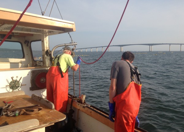
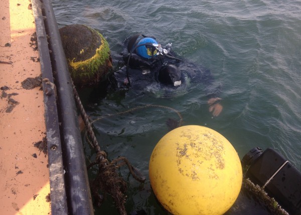
Paterson and Goerner were attaching to the 4,000 pound anchor this underwater lift bag – made by a Rhode Island company!

float bag

So if you enjoy these:

oysters
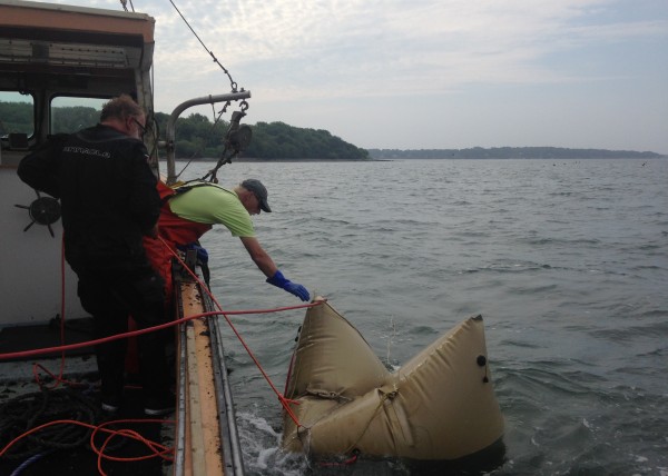
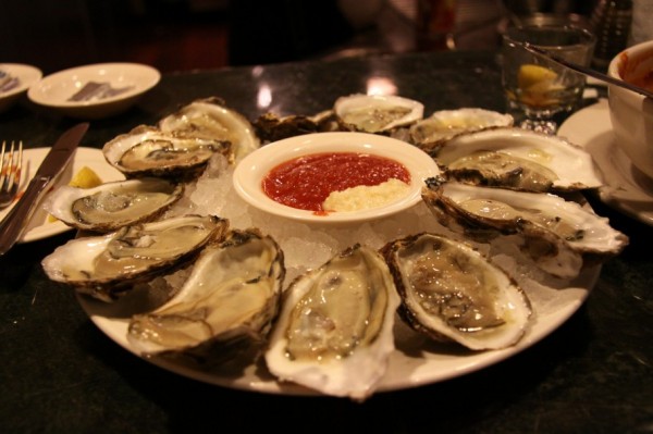
Thank someone like this:

goerner2

Sailing with Governor Chafee


Deprecated: Function get_magic_quotes_gpc() is deprecated in /hermes/bosnacweb08/bosnacweb08bf/b1577/ipg.rifuturecom/RIFutureNew/wp-includes/formatting.php on line 4387

Deprecated: Function get_magic_quotes_gpc() is deprecated in /hermes/bosnacweb08/bosnacweb08bf/b1577/ipg.rifuturecom/RIFutureNew/wp-includes/formatting.php on line 4387

Friday afternoon was the kind of weather that lets Rhode Island lay claim to some of the best sailing on the planet. It was warm but not hot. It was mostly sunny but ample clouds for shade. And and there was a good, stiff breeze blowing in from the north. And although the House Finance Committee had unveiled and passed its budget proposal less than 24 hours earlier, Governor Linc Chafee was not at the State House. He was heeling his sailboat, Swift, up Narragansett Bay into a 10-knot headwind.

chafee sail smile

Chafee isn’t running for reelection, and doesn’t seem to regret the decision. In election years, “the boat stays ‘on the hard’ as they say,” he told me as he took me for a cruise aboard his 33-foot J100. While we sailed he said repeatedly that he’s staying focused on his final months as governor, but he mentioned maybe hiring a headhunter once he’s out of office, and said he isn’t opposed to doing something overseas. I told him he should help bring the America’s Cup back to Newport. He’s got not only the money and the name recognition, but few love the water as much as Linc Chafee.

chafee keeling

Chafee lives in the beach community of Potowomut and his home is right next to a CRMC public right-of-way and popular neighborhood beach on Greenwich Bay, where he can often be seen paddleboarding in the early mornings. He keeps his sailboat – a bigger version of one of the most popular racing sailboats ever built, the J24 – in Dutch Harbor, the mooring field on the west side of Jamestown that can be seen when looking south from the bridge. The cove is flanked by colonial era farms and pastures, a beach or two, several salt marshes and Dutch Island. I once asked Chafee to go surfing with me, but because we agree that Dutch Harbor is just about the most beautiful place in New England, we decided to go sailing instead.

We talked a lot about the highlights of being governor. Chafee boasted of making the state more tolerant and of leading Rhode Island out of a long recession. He said he feels vindicated that the House budget suggests lowering the corporate tax and implementing combined reporting, “bold” moves he suggested in 2012. Central Falls’ recovery, he said, was his highlight as governor.

When I asked him to define his legacy in one word he said:

Several times we discussed his relationship with the media, he seems to have strong feelings about it. He made a point of saying there’s been a lack of media support for social justice issues.

Chafee’s 61 years old, and has been a city councilor, a mayor, a senator and now the governor. He wouldn’t say he was done with politics, and seemed to like the idea of perhaps running for Warwick school committee some day. He told me he may make an endorsement in the governor’s campaign, but didn’t tell me for whom. Instead of pressing him, I asked what young Linc Chafee was like.

When we got back to his mooring in Dutch Harbor, I asked him if he might be interested in buying the Providence Journal.

chafee sail smile2

Will management efforts end eel bootlegging?


Deprecated: Function get_magic_quotes_gpc() is deprecated in /hermes/bosnacweb08/bosnacweb08bf/b1577/ipg.rifuturecom/RIFutureNew/wp-includes/formatting.php on line 4387

Deprecated: Function get_magic_quotes_gpc() is deprecated in /hermes/bosnacweb08/bosnacweb08bf/b1577/ipg.rifuturecom/RIFutureNew/wp-includes/formatting.php on line 4387
DEM monitors glass eels, or baby eels, in the Annaquantucket River in North Kingstown this time of year. (Photo by Bob Plain)

We tend to think of eels only as sushi or bait. But they are also among the most interesting, endangered and expensive fish in Rhode Island waters.

In contrast to river herring, salmon and other anadromous fish (those that live in salt water and breed in fresh water), eels are catadromous. They spend their lives in fresh water and swim out to sea to breed and then die. We know they spawn somewhere in the Sargasso Sea, a section of the Atlantic Ocean west of Bermuda. But their mating ritual remains a secret. Despite many attempts, it has never been witnessed.

The larval offspring randomly float to points all along the northwestern edge of the Atlantic – anywhere from the Caribbean islands to Canadian maritime provinces. Once they’ve reached a coastline, they make their way upriver into fresh water. For the next seven to 20 years they will live in local rivers and lakes, growing to be about two or three feet long, before secretly swimming back out to the Sargasso Sea to spawn and then die.

“It’s one of the great mysteries of the sea,” said Bob Ballou, assistant director of the state Department of Environmental Management. “These fish are amazing.”

In rivers all over Rhode Island right now, these tiny and somewhat transparent baby eels are ruthlessly swimming upstream to find a freshwater home. At this stage of their lives, smaller than 65 centimeters, they are called glass eels, and they are one of the most valuable and threatened species of fish found in New England.

eel graph1
This chart shows the decline in eel populations since 1981. Click on the image for a larger version.

Earlier this week, Ballou attended an Atlantic States Marine Fisheries Commission meeting where it moved forward in developing new interstate regulations for eels. The group will study and discuss a range of options throughout the summer, including a moratorium on glass eel harvesting. In 2011, eels were considered for protection under the Endangered Species Act.

“Eels are going to be an emerging issue,” Ballou told me. “They are going to get a lot more attention.”

Adult eels, or yellow eels, live quietly in our local lakes and rivers and are legally harvested in many states – in Rhode Island they must be at least 9 inches. But the take is very small; though eel is a delicacy in Japan, here they are used just for bait to fish for striped bass.

The glass eel harvest is another story entirely.

It is outlawed in every East Coast state except Maine and South Carolina, where they are sold and shipped to China and farmed indoors for food. “Adult eels are mostly sold in Japan where they are roasted,” according to the Boston Globe, “in the United States, sushi eaters might recognize them as unagi.”

So valuable are the tiny, transparent eels that the ASMFC and others, such as Save The Bay, are very concerned with poaching in one state to bootleg them to Maine or South Carolina. Last year, a pound of glass eels could be sold legally in Maine for $2,000.

“It was like the wild west up there,” Ballou said. “There were reports of people making $150,000 on a good night.”

Last year, at least two poachers were arrested in Rhode Island, according to this ecoRI report. Jack McIlmail, a captain in DEM’s law enforcement division, declined to provide documents relating to any arrests for eel poaching and DEM declined to discuss law enforcement actions concerning glass eels entirely. Ballou said he wasn’t aware of other arrests, and stressed that poaching hasn’t been an issue in Rhode Island. DEM does patrol for poachers though; an enforcement officer was recently at the Mattattuxet River, asking people if they have seen vehicles with Maine or South Carolina license plates.

This season in Maine the price is down to about $1,000 a pound, said Bill Quinby, an international fish broker based in South Carolina who used to business in Rhode Island waters (He coordinated the deal between the DEM and the Russian fish-buying boat in Narragansett Bay). His company Mayflower International is a licensed glass eel dealer in Maine and owns one of only ten harvest licenses in South Carolina and sells them to Chinese and Korean businesses.

There are three types of eels in the world, Quinby explained: Japanese, European and American. An earthquake decimated the Japanese eel population about six years ago and the European fishery is very heavily regulated. This set off the eel boom in Maine.

“It was shortly after the tsunami and earthquake in Japan,” he told me, “and the demand for glass eels for aquaculture in China, particularly, escalated tremendously because they used to get their baby eels from Japan and grow them out for market.”

Dealers would drive around with carloads of cash, Quinby confirmed, and trade Maine fishermen tens of thousands of dollars for their glass eel catch. This year, Maine instituted a quota of 11,000 pounds and transactions are now done with a swipe card.

Save The Bay Baykeeper Tom Kutcher said Maine instituted the quota knowing the ASMFC would be putting new regulations in place. “It’s irresponsible management to let it go on,” he said. “It’s really good pay for really irresponsible work.”

Save The Bay would like to see the ASMFC put a moratorium on all glass eel harvesting. “They are undergoing this incredible decline,” Kutcher said. “At one time they were the highest biomass fish in our rivers.”

Ballou, who is a member of ASMFC American Eel Advisory Board, said there may be room for harvesting a small number of glass eels in Rhode Island someday.

“There is a school of thought out there that if we could do it in a sustainable way, if you had a facility to grow out these eels,” he said. “You could argue that you’d actually get more protection for the resource by capturing some with some sort of innovative approach. It could be beneficial to the resource and have commercial value.”

Deepwater Wind is avoiding whales, John Lang is looking for them


Deprecated: Function get_magic_quotes_gpc() is deprecated in /hermes/bosnacweb08/bosnacweb08bf/b1577/ipg.rifuturecom/RIFutureNew/wp-includes/formatting.php on line 4387

Deprecated: Function get_magic_quotes_gpc() is deprecated in /hermes/bosnacweb08/bosnacweb08bf/b1577/ipg.rifuturecom/RIFutureNew/wp-includes/formatting.php on line 4387
A North Atlantic right whale mother and calf pair in Rhode Island Sound, April 2011. (Credit: Christin Khan, NEFSC/NOAA)

North Atlantic right whales, the most endangered mammal on the planet, were once a regular attraction here in the Rhode Island.

“In February 1828, ‘a Right Whale forty four feet long, and rated at about seventy barrels of oil, was killed in the waters off Providence, R.I., after having been seen for several days ‘sporting in our river’,'” wrote URI Oceanography professor and right whale expert Bob Kenney wrote in the 2010 Ocean Special Area Management Plan.

These massive marine mammals – they can be 50 feet long and more than half that wide – still travel our waters on their annual spring migration from Florida to the Cape Cod Sound. In 2011 57 were spotted in Rhode Island Sound. And in 2010, 98 were noticed here. That’s approximately one-fifth of the remaining population. An endangered species, there are said to be fewer than 500 left in existence.

“Potential impacts on right whiles must be considered for all construction activities or on going operations for any alternative energy development,” wrote Kenney in the 2010 Ocean SAMP.

And so yesterday Deepwater Wind announced that it would add extra precautions as it studies these waters for the first ever large-scale offshore wind farm in the United States.

“We could plow forward with plans and fight it out at the end,” said Deepwater Wind CEO Jeff Grybowski, “or you can decide to embrace solutions constructively.” He said the concessions will cost his company “several hundred thousand dollars.”

The agreement, signed with the Conservation Law Foundation and applicable only to the planning phase of the project, says Deepwater won’t construct weather towers in the spring when whales are likely to be in the vicinity. It also requires the company to employ year-round “real-time human monitoring for whale activity in the site area,” according to a press release.

john lang
John Lang, captain of the MV Ocean State.

This could potentially be good news for John Lang, skipper of the MV Ocean State, a 36-foot center console boat he uses to search for entangled or otherwise distressed whales in the waters of Rhode Island. To his knowledge, he’s the only one actively looking for whales in these waters. Check out his Facebook page here.

“If I could afford to go out every day, I’d find an entangled whale,” he told me as we motored out of Narragansett Bay Thursday. He can’t afford to go everyday, as it can cost him upwards of $1,000 a trip in fuel.

We were planning to “run the trap lines,” or check the network of lobster traps and gill nets used for commercial fishing that can entangle whales and other marine mammals. “There are strings of them, for miles and miles.” His routine is to look anywhere from 20 miles south of Block Island to just east of Nantucket.

Lang says whales frequently become entangled in fishing gear, and research shows it is a major cause of unnatural whale death. In 1995, an entangled right whale washed up dead on Second Beach in Middletown, and in 2000 an entangled right whale was found floating dead off Block Island.

In other states, networks of volunteers and scientists monitor offshore waters for entangled whales. Lang thinks the only reason entangled whales are being spotted off Rhode Island is because no one is looking.

mv ocean stateA wildlife cinematographer by profession who earlier studied the spotted owl, Lang sailed solo from Miami to the Ocean State four years ago and decided to stay. Last year, he decided to help protect whales while he’s here.

“I can drive a boat and I’ve always worked with endangered species,” he said. “That’s the core of the mission. If I get an email from the network, there’s a good chance I can find that whale and wait with that whale until the recovery team comes. Nobody else as far as I know would be ready to go in a moment’s notice in a boat that can go 50 here in Narragansett Bay.”

He has yet to see a whale, but for the time being he’s willing to invest his own money in looking.

“I’m gonna have to be patient,” he said. “It might take a year or two, it might take two or three years. But at some point, though, we will, we will get our whale.”

RV Endeavor studies global oceans, makes money for URI


Deprecated: Function get_magic_quotes_gpc() is deprecated in /hermes/bosnacweb08/bosnacweb08bf/b1577/ipg.rifuturecom/RIFutureNew/wp-includes/formatting.php on line 4387

Deprecated: Function get_magic_quotes_gpc() is deprecated in /hermes/bosnacweb08/bosnacweb08bf/b1577/ipg.rifuturecom/RIFutureNew/wp-includes/formatting.php on line 4387
endeavor_bridge
Looking from the bridge of the RV Endeavor back towards the Bay Campus and the Coastal Institute.

The RV Endeavor is one of the ways the Rhode Island is already a national center for studying climate change.

endeavor1The 185-foot research vessel (or RV) is staffed by URI’s Graduate School of Oceanography and its home port, the Bay Campus. But it’s owned by the National Science Foundation, and it’s paid for and used by whomever happens to need to study planet Earth’s vast oceans.

“We’re a charter boat for scientists,” said Second Mate Chris Armanetti.

Tuesday the Endeavor leaves on a 30-day trip to Iceland, where Princeton geoscientist Bess Ward will be studying how phytoplankton reacts to different forms of nitrogen. “Some of the kinds of phytoplankton that we think are really important are actually sucking carbon into the ocean,” Ward explains as she readies her equipment in the boat’s main lab for the long trip.

endeavor_painterThis is the second time her research has taken her aboard the Endeavor, which is one of 24 research vessels in the world equipped to help unlock such scientific mysteries, which Ward assured me are much more crucial than they sound in the abstract. “We care how our ocean ecosystems will respond to global change.”

Her and eight grad students are traveling more than 2,000 nautical miles to study these phytoplankton at their richest, which is off the coast of Iceland in the North Atlantic during spring. They will be accompanied and assisted by the Endeavor’s crew of 12, who work in three shifts with four people on duty at any given time.

The Endeavor isn’t cheap to operate. Ward, whose grant is for $3 million, is paying URI $24,000 a day for its services.

“It’s important both scientifically and financially,” said Tom Glennon, the director of marine operations for the Graduate School of Oceanography, who said the Endeavor makes between 10 and 12 such trips a year.

“It’s a money spinner for the university, for sure,” said technician/crew member Bill Fanning.

Glennon and Fanning chatted over a catered lunch on the boat after two tractor trailer trucks worth of food were stored on the boat for the trip to Iceland and back. The Endeavor serves three meals a day, with dinner menus ranging from chili to filet mignon, while at sea.

endeavor_kitchen

There’s a small dining room, and an even smaller library with a few couches. And other than that, the creature comforts are few and far between. There are small bunk rooms in the hull, with cramped bunk beds in small rooms. Most share bathrooms.

endeavor_dining room endeavor_library

The bulk of the boat is research space. There are three labs on the boat, and most of the deck is for lowering equipment into the depths of the ocean. The cable they were winding the day I visited could stretch 8,000 meters into the sea.

The Endeavor has been all over the world, save for the Indian Ocean. Recent trips include Peru, Hawaii and Scotland.

endeavor2“It’s driven by the science,” said Tom Orvosh, an technician and crew member. “It can get pretty intense at times, if the weather’s rough and people can’t get their work done.

Crew members say seasickness isn’t really a problem for visiting scientists because it usually passes after several hours.

The Graduate School of Oceanography has housed a world-class research vessel since 1962, when legendary dean John Knauss helped the school acquire the RV Trident. In 1977, it replaced the Trident with the Endeavor. The Endeavor was retrofitted in 1992, but it’s nearing the end of its tenure. Crew members said such boats are good for about 30 years, and that it would cost roughly $65 million to replace her.

endeavor_wheelhouse

The buckies are back, but not better than ever


Deprecated: Function get_magic_quotes_gpc() is deprecated in /hermes/bosnacweb08/bosnacweb08bf/b1577/ipg.rifuturecom/RIFutureNew/wp-includes/formatting.php on line 4387

Deprecated: Function get_magic_quotes_gpc() is deprecated in /hermes/bosnacweb08/bosnacweb08bf/b1577/ipg.rifuturecom/RIFutureNew/wp-includes/formatting.php on line 4387

The alewife are always the first to know it’s spring in Rhode Island.

buckies

Better known as river herring – or, as the old timers call them, buckies – these small and once-abundant anadromous fish spend their summers, autumns and winters in the Atlantic Ocean and as soon as the weather shifts to warm, they swim into our fresh water streams to mate and hatch their young.

herringThey are silvery, with purplish backs and are only about six inches long. At first they can be tricky to spot in the water. But once your eye picks them up, it quickly becomes evident that a river is flush with them, swimming against a sometimes swift current to get to their spawning grounds.

They can be found all over coastal Rhode Island this time of year – Nonquit Pond in Tiverton, Buckeye Brook in downtown Apponaug and even the Woonasquatucket River in Providence.

By far the biggest and best-known buckie run has always been on the Mattatuxet River, said Department of Environmental Management biologist Phil Edwards. On Sunday, the caretakers of Gilbert Stuart’s birthplace, a colonial-era homestead 5 five miles upstream from Narragansett Beach, noticed they were back.

gilbert stuart

For the next several weeks, thousands of river herring will navigate a fish ladder that circumvents the waterfall and swim into Carr Pond to hatch their young. The adults will head back out to sea in May and the next generation will follow when the weather cools down in September.

Undated photo courtesy of Save The Bay.

The buckie runs were once the stuff of legend in Rhode Island. The precolonial Narragansett Indians harvested them for fertilizer and up until the 1950’s hundreds of metric tons were caught annually for bait or for early season fish fries.

As late as the 1980’s and 1990’s kids and adults could collect buckets of buckies with a net. Even in the early years of this century, the tenants at the Shady Lea Mill, less than a mile and a half upstream of Gilbert Stuart had access to all the herring they could eat.

But then the population of river herring in Rhode Island pretty much dried up. The Gilbert Stuart run went from 290,000 in 2000 to just 17,000 in 2004 – a 95 percent reduction. So far this year I haven’t seen one herring at the Shady Lea Mill. The National Marine Fisheries Service listed them as a “species of concern” and imposed a moratorium on their catch.
river herring chart“We still don’t have a good handle on the cause, and it is probably related to a number of things including water quality, lack of spawning habitat, climate change, predation, and by-catch,” said Rachel Calabro of Save The Bay. She’s written about the river herring here and here.

The National Oceanic and Atmospheric Administration says the overall population began to drop off in the late 1960’s when “distant-water fleets began fishing for river herring off the Mid-Atlantic coast.” In Rhode Island, the decline quickened in the years after a Russian off-loader boat parked off Jamestown and bought mackerel and herring from local fishing boats.

Glen Goodwin, captains the trawler the Persistence out of Davisville and sells his catch to Sea Freeze, a Quonset-based seafood freezing company that sells seafood all over the world. He fishes for herring, but not the anadromous kind that spawn in rivers. He and other local fishermen catch sea herring, a different species of fish altogether.

“Sea herring has the largest quota on the coast that actually realizes its quota,” he told me.

The problem is the two kinds of herring congregate together, so fisherman have to be much more meticulous about which species they pull up in their nets. “River herring are taken as bycatch in other ocean fisheries in various gear types including gillnets, bottom otter trawls, and menhaden purse seines,” according to NOAA.

Goodwin says fishing boats have sensors that can identify a species before dragging the net, and the two kinds of herring don’t mix together as much during the day as they do at night. “It’s not 100 percent, but in the last ten years we’ve put a lot more effort into avoiding them,” he said.

“I realize that they try very hard to not catch river herring,” Calabro said. “There may be ways to avoid them better, like fishing farther out, because the river fish tend to stay in close waters, but it is a challenge.”

Federal beach monitoring money in jeapardy


Deprecated: Function get_magic_quotes_gpc() is deprecated in /hermes/bosnacweb08/bosnacweb08bf/b1577/ipg.rifuturecom/RIFutureNew/wp-includes/formatting.php on line 4387

Deprecated: Function get_magic_quotes_gpc() is deprecated in /hermes/bosnacweb08/bosnacweb08bf/b1577/ipg.rifuturecom/RIFutureNew/wp-includes/formatting.php on line 4387
Click on the map for a larger version.

Ocean State swimmers may have no way of knowing when Narragansett Bay has dangerously high levels of fecal coliform near state beaches and town parks because the federal funding for the program is slated to be cut, according to this new report.

“This is a science-based survey that shows where and when we need help in making sure we are protecting the health of citizens, and avoiding negative impacts on the economy,” said Nicole Rohr, assistant director of the URI Coastal Institute, in a press release. “Failing to realize what needs to be monitored and assessed with regard to the protection and management of our natural resources will impose substantial costs to Rhode Island’s economy, quality of life, and public health.”

Beach water quality monitoring tracks, among other things, pollutants like fecal coliform at state beaches and town parks on Narragansett Bay and is funded by the EPA. It costs about $200,000 annually. The monitoring results instruct DEM on which beaches need to be closed to prevent swimmers from becoming sick because of high levels of fecal coliform, from faulty sewer systems and other pollution, in the Bay.

This summer there were more than 100 instances when swimming could have led to illness. Without this monitoring program there would be no way to know when water at state beaches and town parks is dangerous for swimmers.

RIF reported this summer that beach closures have a detrimental effect on Rhode Island’s summertime economy. Not knowing when a beach should be closed would have an even worse effect!

Is it Scalloptown, or the EG Riviera?

harvesting the bay huling
For more on the rich tradition of quahogging in East Greenwich, click on the image to read about this excellent book.

I don’t often have opportunity to agree with Don Carcieri, but I certainly do when it comes to East Greenwich. We both grew up here and share a deep love for our hometown and its working waterfront. A great profile in the Providence Journal shows that in many ways, that working waterfront is still the same.

But it is also disappearing, going the way of the neighborhood grocery and hardware stores into extinction.

While we still boast the second largest concentration of bullrakers in Rhode Island, next to only nearby Apponaug, all across the Ocean State commercial fishing is going away.

There are only about 2,000 licensed quahoggers left in Rhode Island. Only 93 are younger than 40. And for every two people that have retired since 2005, only one new shellfisherman has taken up the profession.

Bob Ballou, who oversees marine affairs and commercial fishing for DEM, recently told a group  at the URI Bay Campus studying shellfish management in the state that the number of licenses is unrelated to the resource supply. You can check out his entire presentation here.

Bullrakers agree that there are plenty of quahogs in the Bay. But the price, they say, is being continually driven down by lower-quality, farm-raised clams from the southeastern states. It turns out, a lot of people outside the Ocean State enjoy shellfish too. But they don’t necessarily pay a premium for the wild harvested ones we are famous for and know taste a million times better. Even some renegade Rhode Island restauranteurs have been known to sneak in some the cheaper farm-raised ones into their entrees.

Progressives like me and conservatives like Carcieri – who don’t often have opportunity to agree – ought to be able to work together to preserve the working waterfronts of Rhode Island by helping to grow and celebrate this important part of our heritage AND our economy.

The next meeting of the Shellfish Management Plan is Tuesday, 5:30 at the Bay Campus.

Leatherback turtle rescued from fishing rope off RI


Deprecated: Function get_magic_quotes_gpc() is deprecated in /hermes/bosnacweb08/bosnacweb08bf/b1577/ipg.rifuturecom/RIFutureNew/wp-includes/formatting.php on line 4387

Deprecated: Function get_magic_quotes_gpc() is deprecated in /hermes/bosnacweb08/bosnacweb08bf/b1577/ipg.rifuturecom/RIFutureNew/wp-includes/formatting.php on line 4387
Rescuers from Mystic Aquarium freed a Leatherback turtle from fishing equipment last week. (submitted)

We don’t know too much about the giant leatherback turtles, the world’s second biggest reptile behind the crocodile, that summer offshore of the Ocean State and all over the Eastern Seaboard.

We know they come to feast on jellyfish. We know the females lay eggs in surf-side nests in South America, the Caribbean and as far north as Florida and that the males never again return to shore. But we don’t even know how long they live. After they hatch they swim sometimes thousands of miles out into the deep sea and even researches don’t see much of them again.

Until, that is, they are in trouble.

Such was the case on Thursday when a team from Mystic Aquarium and the U.S. Coast Guard rescued a 600-pound leatherback turtle that had become entangled in commercial fishing equipment four miles off the coast of Charlestown, RI.

Leatherback_2

Leatherbacks, so named because their so-called shells aren’t hard like other turtles, are one of the charter members of the Endangered Species list. With no natural predators other than human egg poachers, abandoned fishing equipment is the world’s biggest turtle’s biggest threat.

leatherback location
Click on map for a larger version.

The turtle rescued last week got caught in some rope that was attached to a buoy 4.5 miles south from little-known Quonochontaug Beach and 5.5 miles from well-known Miscquamicut Beach (about 8.5 miles northwest of Block Island), where the ocean is about 100 feet deep.

Being too far off the coast for the Charlestown harbormaster to respond, a seven-person Coast Guard team assisted a three-member rescue squad from the Aquarium. It took them about 45 minutes to free the leatherback, said Janelle Schuh, a stranding coordinator for Mystic Aquarium.

Leatherback_1“It had a significant number of wraps around one of it flippers,” she said.

“They usually don’t cooperate very well. There’s lot’s of flailing of their flippers,” she added, noting that their flippers are three-feel long. “Basically, they are just trying to get out of the way.”

Mystic Aquarium took video of the rescue, and released about a minute of footage to the public.

“Leatherback turtles occur relatively commonly in the Rhode Island study area,” according to a 2010 study of marine mammals and reptiles by URI marine biology professor Robert Kenney. Almost all are spotted in summer or fall, and most are seen from pleasure or whale watching boats in the same general vicinity that this where this Leatherback was found.

Interestingly enough, his research also indicates many of the regional Leatherbacks strandings occur in Rhode Island waters (p. 337).

Leatherback strandings are relatively common in Rhode Island, however we did not have access to most of those records … of the 146 sea turtle strandings responded to by Mystic Aquarium from 1987 to 2001, 124 (84.9%) were in Rhode Island, and 120 of the 146 were leatherbacks.
Mystic Aquarium encourages the public to use its 24-hour hotline at 860.572.5955 ext. 107 if they encounter a marine mammal or sea turtle in Conn., R.I. or Fishers Island, N.Y.
Leatherback_4

Surf casting, East Beach


Deprecated: Function get_magic_quotes_gpc() is deprecated in /hermes/bosnacweb08/bosnacweb08bf/b1577/ipg.rifuturecom/RIFutureNew/wp-includes/formatting.php on line 4387

Deprecated: Function get_magic_quotes_gpc() is deprecated in /hermes/bosnacweb08/bosnacweb08bf/b1577/ipg.rifuturecom/RIFutureNew/wp-includes/formatting.php on line 4387

Contrary to popular belief, East Beach isn’t just a summer haven for folks wealthy enough to afford a second home. People of all economic stripes come for the pristine surf casting conditions here on the coast of western Charlestown, where a wide swath of sand dunes is all that separate the salt pond from the steep and deep drop-off into the Block Island Sound.

east beach dune To the west, a father and son cast at sunset.

east beach dad fishing1east beach dad2To the east, there is a much larger contingent of fishermen surf casting into the Block Island Sound.

east beach fishingeast beach surfcastVideo:

Of course, East Beach is best known for long empty stretches of sand.

east beach looking westeast beach sand bunkereast beach

Upper Narragansett Bay, aka the Providence River

The Providence River doesn’t technically become Narragansett Bay until Conimicut Light in Warwick, but for all aesthetic, commercial and ecological purposes it’s brackish water – a mix of salt and fresh water – that we manage as part of The Bay.

If you aren’t familiar with it from the water, this is what it looks like:

And some pictures:

pvd narragansett bay
Downcity, Providence from the upper reaches of The Bay.
And here's downtown as seen from behind the Field's Point windfarm.
And here’s downtown as seen from behind the Field’s Point windfarm.
Field's Point wind farm
Field’s Point wind farm
fields point wind farm
Field’s Point wind farm

There are two lighthouses in the Providence River/upper Bay area:

Ponham Light is in East Providence.
Conimicut Light, in Warwick, is where the Providence River technically gives way to Narragansett Bay.

These next few pictures are of a giant road salt pile at Field’s Point that I fear is probably contributing to the pollution in Narragansett Bay. The salt probably isn’t as bad as whatever the salt is mixed with.

salt pile1 fields point salt pile skyline1 fields point salt pile2 fields point

Looking for oxygen in Narragansett Bay


Deprecated: Function get_magic_quotes_gpc() is deprecated in /hermes/bosnacweb08/bosnacweb08bf/b1577/ipg.rifuturecom/RIFutureNew/wp-includes/formatting.php on line 4387

Deprecated: Function get_magic_quotes_gpc() is deprecated in /hermes/bosnacweb08/bosnacweb08bf/b1577/ipg.rifuturecom/RIFutureNew/wp-includes/formatting.php on line 4387

insomniacsRampant beach closures are bad for business but Rhode Islanders should be equally concerned with the potential for another fish kill this summer, said Save The Bay Baykeeper Tom Kutcher as he and a team from Brown University took water samples from around the upper Bay to monitor the oxygen levels in the water.

The group calls themselves the Insomniacs, because they used to do their research at night, and their work is critical if the Ocean State is to know when the oxygen levels in Narragansett Bay get low enough to leave millions of fish dead, as happened in 2003 in Greenwich Bay.

“All it will take is a school of blues to chase a school of pogies into a low oxygen zone and trap them there for a few hours and we could see another fish kill,” Kutcher said. “The conditions are as bad as they were but we aren’t seeing that big signal that gets everyone’s attention. Why should we wait for the fish to die? Let’s take action.”

DEM and URI officials told me the same thing last week.

Beach closures and hypoxia, the scientific term for low oxygen events, are part and parcel of the same environmental problems. They are both fueled by heavy rains, hot weather and stagnant water mixed with high levels of sewage and suburban runoff. Beaches close because of bacteria levels in The Bay are harmful to humans, but some of that same pollution, namely lawn fertilizers and pet poop, also causes rampant underwater plant growth. When those floating plants die, they sink to the bottom and starve Narragansett Bay of oxygen. When Narragansett Bay doesn’t have sufficient oxygen – as has been the case this summer – fish die.

David Murray, an environmental science professor from Brown University who leads the Insomniac team, helped design a meticulous monitoring system in order to stave off a disaster like Greenwich Bay experienced in 2003 when more than a million fish died because of low oxygen levels in The Bay.

His group tests 25 different spots on the upper Narragansett Bay – from the Seekonk River to Conimicut Point in Warwick. At each spot they slowly lower a $20,000 piece of equipment from the surface to the bottom. The monitoring machine is attached to a laptop, and it instantly communicates the oxygen levels in the water.

Another group, the Day Trippers, similarly monitors the East Bay. URI and state researchers use semi-permanent buoys to take similar readings in the West Bay and lower Bay. Everyone’s research says the same thing: increasingly hypoxic waters pose a major threat to sea life in Narragansett Bay ecosystem, and by extension the Ocean State economy.

pvd narragansett bay

Bay pollution hurts Oakland Beach, Ocean State economies

Beach closures due to polluted Narragansett Bay water is harming Warwick’s summertime economy, said Mayor Scott Avedesian and several state legislators at a Save The Bay press event at Oakland Beach today. But don’t take their word for it, I asked the people who actually come here and spend money:

Chris Cifelli is the general manager of the Iggy’s, the West Bay’s best-known clam shack that abuts Oakland Beach. He wouldn’t go on camera but he told me beach closures have a significant affect on business. “There’s no doubt. People don’t come if the beach is closed.”

He said they still get a healthy lunch and dinner crowd “but in the afternoon, when people stop in after going to the beach, we don’t have that anymore.”

tom kutcherBeach closures due to heavy loads of sewer and road runoff have become commonplace in the West Bay. Warwick beaches dominate the list of most days closed due to pollution both this year and since the state began keeping records in 2000. City officials acknowledge Warwick has far too many failing suburban septic tanks.

The General Assembly this year, as in past years, failed to act on legislation that would require septic system upgrades for failing systems if and when the real estate is sold. There are more than 25,000 septic systems in Rhode Island that fail to prevent waste from leeching into groundwater and, by extension, Narragansett Bay.

Click on the map for a larger version.

But this year beach closures are no longer an isolated issue in the upper areas of Narragansett Bay. Climate change is warming our water and causing more summertime moisture all alonf the East Coast; as a result the pollution problems of the warmer, shallower, upper parts of Narragansett Bay now belong to the lower Bay too.

Narragansett and Newport, two of the Ocean State’s most iconic beach towns whose reputations and economies are directly linked to the success of the summer crowd, have both experienced a record number of beach closures this summer.

Rep. Teresa Tanzi, Narragansett/South Kingstown, said the economic effect is bigger than just individual dollars not spent because of beach days missed.

“It’s a loss of confidence that people have in our reputation,” she said – those who vacationed in Rhode Island this year and missed a day of swimming at Bonnet Shores or Narragansett Town Beach might decide to go to Connecticut or Massachusetts beaches next year.

“It affects all of Rhode Island,” she said.

This loss of confidence certainly seems to be having an effect on Oakland Beach this year. It was a perfect beach day, and the water was deemed clean, but there was almost no one swimming.

Warwick hit particularly hard by beach closures


Deprecated: Function get_magic_quotes_gpc() is deprecated in /hermes/bosnacweb08/bosnacweb08bf/b1577/ipg.rifuturecom/RIFutureNew/wp-includes/formatting.php on line 4387

Deprecated: Function get_magic_quotes_gpc() is deprecated in /hermes/bosnacweb08/bosnacweb08bf/b1577/ipg.rifuturecom/RIFutureNew/wp-includes/formatting.php on line 4387
Oakland Beach, 2012
Oakland Beach, 2012

Oakland Beach is a bustling, if out-of-the-way, summertime economic engine on Greenwich Bay in Warwick. There’s a popular clam shack, some sit down places, a few mini-marts and even a Harley Davidson dealer … all of which are in business to make money off those spending a summer day at the beach.

Meanwhile, the beach here has been closed to swimming for almost all of July and 24 days in total since mid-June.

Oakland Beach is the poster child for why beach closures matter to the Ocean State. This community’s economy, like so many in Rhode Island, ebbs and flows with the strength or weakness of summer. But Oakland Beach’s proximity to suburbia and its calm, warm waters have become it’s biggest detriments. These conditions are a perfect storm for a beach too polluted to swim at.

The issue is widespread in Warwick, where local beaches have been closed or almost 50 days in total this summer. From 2000 to 2012, according to health department data, Conimicut Point in Warwick has been closed more than any other beach in the state, with 230 days. Oakland Beach is second with 190 closed days. City Park in Warwick had its beach closed 119 times since 2000 and Goddard Park has been closed 110 times. There are only two other beaches in the state that have been closed more than 100 days during that time.

This is why Save The Bay has invited state legislators and Warwick Mayor Scott Avedesian here for a press event.


Deprecated: Function get_magic_quotes_gpc() is deprecated in /hermes/bosnacweb08/bosnacweb08bf/b1577/ipg.rifuturecom/RIFutureNew/wp-includes/formatting.php on line 4387